Preserving Chaco: Part 2
Projection Mapping Physical Terrain Models for Spatial Storytelling
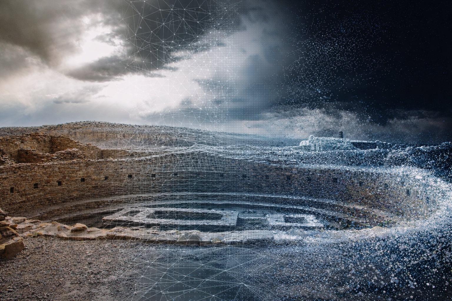
Extending the Model into Light
The physical terrain model described in Part 1 establishes form, scale, and material presence. On its own, it allows viewers to grasp the canyon’s geography in a way that maps and screens rarely do. But it is intentionally incomplete.
Landscapes like Chaco are not static. They are shaped by the movement of people, light, and time. Roads connect distant Great Houses. Solar and lunar cycles trace predictable paths across mesas and canyon walls.
This second phase of the project explores how projection mapping can introduce those temporal and analytical layers.
From Object to Instrument
Rather than treating the terrain as a display surface, the projection system is designed to function as an analytic instrument, a way to reveal relationships that already exist in the landscape but are challenging to perceive all at once.
The focus isn’t on spectacle, but on alignment, bringing spatial, temporal, and interpretive layers into conversation with one another.
To support that goal, the workflow separates responsibilities across four tools:
- Python for converting Lidar data into a digital and physical models
- After Effects for composing visualization layers
- MadMapper for geometric alignment and projection mapping
- Premiere Pro for documenting and sequencing the system in use
Each tool is used narrowly and deliberately, reducing complexity while preserving flexibility.
Visualization Layers as Proof of Concept
The visualization layers are composed in After Effects. Currently these compositions are not yet narratives; they function simply as proofs of concept, testing how different types of information behave when projected onto uneven terrain.
Current layer types include:
- satellite imagery for spatial context
- simple arrows and labels to trace alignment or movement
- soft spotlight masks to guide attention
- light-based simulations, such as clouds or moonlight
Animations are intentionally slow and minimal. Projection amplifies contrast and motion, and restraint improves legibility while not overwhelming the physical terrain. The emphasis is on how clearly information reads when light interacts with slope, elevation, and surface texture.
The output from After Effects is a single video file, which can be revised independently of the physical setup.
Projection Mapping and Geometric Alignment
MadMapper is used exclusively for projection mapping and warping. A fixed projector and physical model allow the digital content to be bent to match the terrain’s geometry.
The video accompanying this post demonstrates the effect of this alignment. Without correction, the imagery floats and distorts across elevation changes. Shadows fall on peaks, and the great houses are lost in the noise. With warping applied, overlays conform to the terrain, preserving spatial relationships and legiblity even across steep slopes.
Once this alignment is established, new visualization layers can be introduced without reworking the mapping, making the system stable and repeatable.
Light as a Narrative Medium
One of the advantages of projection over physical overlays is impermanence. Light can appear, recede, and shift without altering the object beneath it.
Cloud simulations, for example, introduce movement that references weather and atmosphere without asserting interpretation. Moonlight overlays hint at astronomical cycles without requiring explanatory text. Spotlights isolate features temporarily, encouraging viewers to linger and engage with the terrain through a push button interface. The goal is to slow attention and let relationships emerge.
These choices are intentional. The goal is not to commit to a singular and exhaustive explanation of Chaco upfront, but to make this a project that can evolve over time.
Project Status
As demonstrated in the accompanying video:
- the test terrain model is complete
- visualization layers are functional
- projection mapping is stable
- the technical stack is fully integrated
What remains is not technical work, but curatorial direction: decisions about which stories to tell, which data layers to surface, and how viewers should move through the larger experience.
Because the data layer is digital, those decisions can evolve without requiring changes to the physical model itself.
Looking Ahead
Projection mapping does not replace traditional archaeological interpretation, nor is it a substitute for visiting Chaco in person. It is a complementary tool, one that allows spatial, temporal, and analytical perspectives to coexist in a single physical frame.
Together, the physical terrain and projected light form a foundation for education, research, and advocacy. The system is intentionally adaptable, and open-ended, designed to support future work rather than define it prematurely.
In this sense, the technology is only a means. The real work remains centered on stewardship, understanding, and care for a landscape that has endured far longer than any of the tools used to represent it.