Articles Tagged: Chaco Canyon
Tags
All Posts
Python (5)
AI (4)
Chaco Canyon (3)
Automation (2)
Dash (2)
Decision Science (2)
GIS (2)
JavaScript (2)
Management (2)
Strategy (2)
3D Printing (1)
After Effects (1)
Conservation (1)
Data Visualization (1)
Date Visulization (1)
Docker (1)
Face Tracking (1)
Flask (1)
Interactive (1)
Linux (1)
Metadata (1)
Photography (1)
PostgreSQL (1)
Projection Mapping (1)
Simulation (1)
Spatial Visualization (1)
Stubby (1)

2026-01-25
Everly
Preserving Chaco: Part 2
Projection Mapping Physical Terrain Models for Spatial Storytelling
2026-01-19
Everly
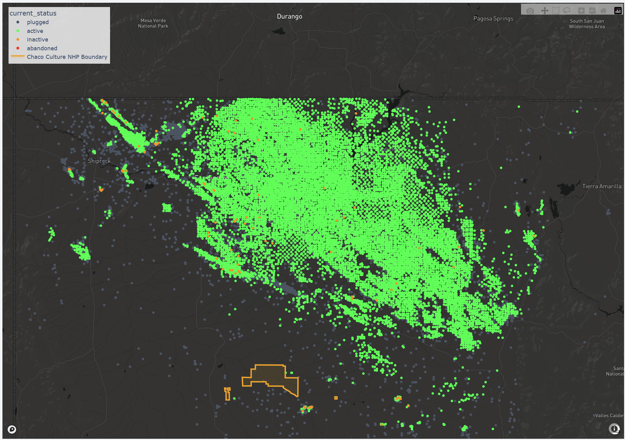
Mapping the Industrial Fringe: Visualizing Well Expansion Near Chaco
Using time-based mapping to understand decades of oil and gas development surrounding Chaco Culture National Historical Park.
2026-01-10
Everly
Preserving Chaco: Part 1
Bridging Archaeology and Automated Fabrication with Python